
Life isn’t easy along the crater of the dormant Tweed Volcano. As it hasn’t been since Gondwana time.

Elements have changed drastically in our sphere.

Ancient giants are the only reminders of the super-continent. As the Australian landmass travelled north some many million years ago, the Tweed Valley was exposed to unstable tectonic plates. Magma broke through the earth’s thin crust, unearthing volcanoes radically. As the Australian continent shifted further towards the equator, these volcanoes slowly eroded with wind and water. Establishing extremely fertile turf to thrive.

Most of the soil around the Border Ranges has succumbed to farming over the years, tree logging has been another destructive measure. If we only knew then what we knew now! But there’s hope.

The vast majority of this important National Park is inaccessible for humans. It needs to be.

Most Flora and Fauna here and in neighbouring highland National Parks, can’t be found anywhere else in the world. And I couldn’t find any of them.

As the name may suggest, these ranges run the border between Queensland and New South Wales.

This, and neighbouring National Parks, are listed as World Heritage.

I arrived at the southern entrance, between Kyogle and Murwillumbah, on a glorious morning.

Cold dawns and calm sunny days aim for spectacular photography.

I couldn’t wait to explore this lost world on foot. Or following my drone ‘Maverick’ with a birds-eye view.

The gate into the National Park was locked. It was unsafe to travel onwards due to severe weather systems of late. I almost chucked a tantrum like a boy in a candy store. That’s NOT fair. I just passed the park’s road-sign and it said all roads are open. (Turned out later, that the sign was correctly sign-posted). Now what? A coffee and a look on the map was required, to examine my location and situation.

I wasn’t willing to give up, not on a day like today. There’s only a two-day window before rain clouds are forecasted again. I haven’t taken my mountain bike for an off-road cycle for a while. I wonder if I could cycle to the top of the mountains?!

A little bit up, and a little bit down again. That’s how it goes, right? I often surprise myself about my abilities, naiveness and misconceptions combined. Camera, check. Drone, check. Water and müsli-bars, check. Sturdy shoes and gloves? Nah, she’ll be right. Let’s go! The first 500 meters went downhill on loose gravel. I picked up some speed and up we go. It wasn’t long until everything stopped. Huffing and puffing, sweat running down my back. Wow, I clearly didn’t expect that. I can’t cycle this steep slope on loose gravel. I started pushing my bike for 100 meters, stopped, and pushed a hundred meters more.

The scenery was nice but I am going nowhere fast. There weren’t any downhill, or at least even par levelled tracks. The only way is up!

I was happy to see the picnic sign for ‘The Bar Mountain’ some long time later. But why is this road blocked up here as well? Wouldn’t it be closed at the western entrance?

I was glad to sit on the picnic table, catching my high altitude breath. Sweat was draining out of my ears and I was still huffing and puffing.

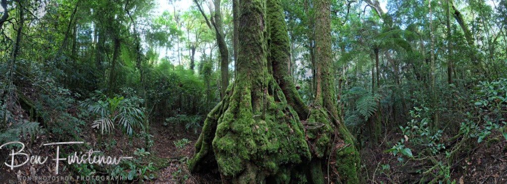
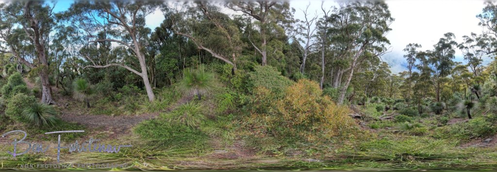
But it’s nice here. Green was all around me.

Nature doesn’t waste any opportunity to cultivate life.

Towering old trees surrounded me, scrambling for sunlight.

Ferns harvest the little sunlight that’s left on ground level.
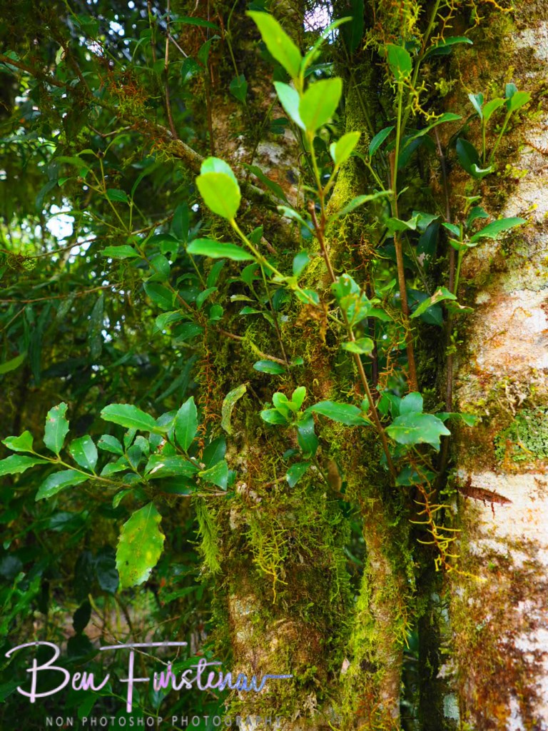
All sorts of fungi were hanging on and off each other.

Ancient natural history evolving in front of me.
This laborious exercise was worth the effort.

A makeshift shelter opts for a cover of the elements. This fireplace has been used uncountable times in years gone by.
I am on top of the world.
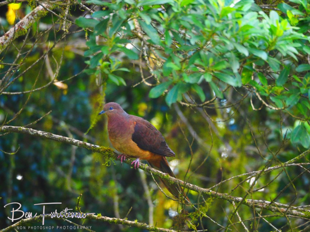
A colourful pigeon joined me for a drink of water.

How elegant. And how pretty.
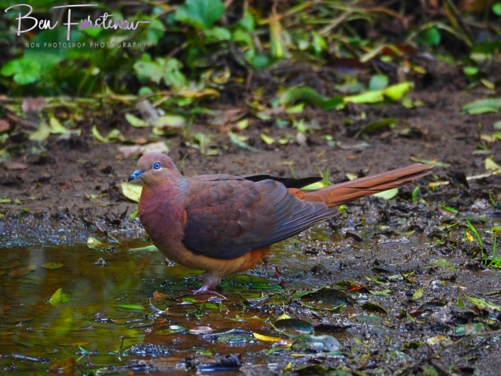
I don’t think I have seen a colourful pigeon like this before.
Well, it was decision time. It’s only about lunchtime now but I still had a fair distance to go. Or to push.

My aim this morning was to reach ‘The Pinnacle’, which is still a few kilometres from here.

‘The Bar Mountain’ picnic area is the highest elevated point on this side of the mountains, I found out later. And so it went downhill on a steep slope again for quite some time.
Dirt and loose gravel were difficult to navigate, I couldn’t go fast. It was when I pushed my GT mountain bike uphill again when a 4 wheel-drive ute came around the corner. He waved politely as he passed me by, as I wavered my sanity. Where did he come from? He wasn’t a park warden either.

It was starting to get late and I realised that I wouldn’t make it to ‘The Pinnacle’ today. But I gave it a good crack. My legs were starting to gel and only a few hours of sunlight left were left.

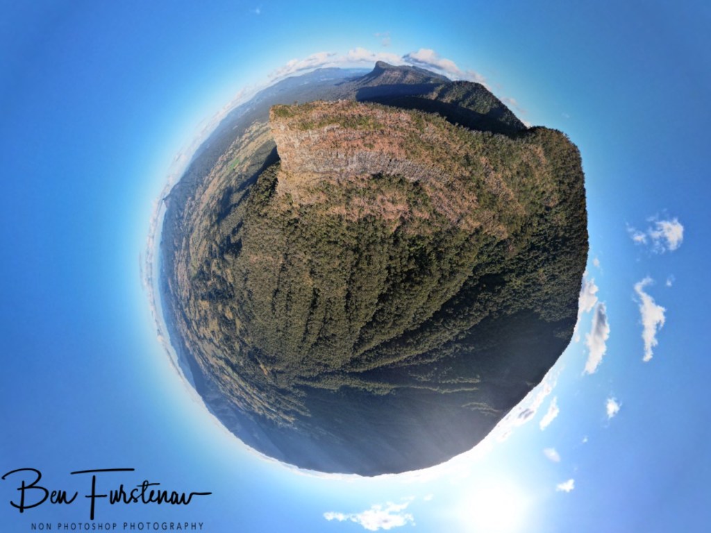
I halted at ‘The Blackbutt Lookout’ for a spectacular view over the Tweed Valley.

Wow, Mount Warning is easily recognised on the eastern rim. I get to fly Maverick after all. The young couple from the all-wheel-drive enjoyed the scenery just as well. But, how did they get their car up here? Isn’t the other entrance closed as well I wondered? I wasted no time and got straight to the point. They seemed surprised about my question and wondered how else I got here.

Turns out, that the western entrance is open to vehicular traffic. I chuckled to myself as I set Maverick up. Oh boy, gotta read the signs properly. At least now I know what I will do tomorrow.

Maverick captured some fabulous photos over the Tweed Valley and Mount Warning, the tallest peak in Northern New South Wales. But I was surely running out of time and light soon. Unfortunately, it was time to backtrack home. The uphill track to Bar Mountain from this side is just as steep as from the other flank. My legs felt it. But from there it’s only downhill.

I was happy and exhausted when I reached Troopy again. What a round trip this has been.

I edged the Border Ranges. Fabulous.
